


Artec Jet
High-Precision SLAM LiDAR Scanner For Any Environment
- Combines high-resolution LiDAR sensors with industry-leading SLAM technology to capture detailed point clouds quickly.
- Offers multiple deployment modes in a single compact, lightweight device. Capture by hand, or mount to a backpack, robot, vehicle, or drone.
- Built for demanding applications in mining, construction, defense, public safety, and civil infrastructure.
🏷️ Looking for a good price on Artec 3D scanners? See if you qualify for any special discounts or promotions.
Technical Specifications
- Mapping Method: SLAM-based LiDAR mapping, ±0.03% drift
- LiDAR Sensing Range: 0.5–300 m (1.6–984 ft)
- LiDAR Accuracy: ±10 mm (3/8 in)
- Point Cloud Formats: LAS, LAZ, PLY, E57
- Outputs: Full resolution point cloud, decimated point cloud, trajectory file
* Please read the brochure for the full technical specifications.
Brochure
- For more information, please read the Artec Jet brochure.
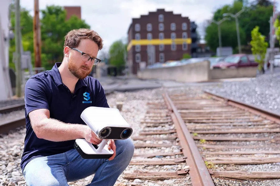
Artec Jet is a complete mobile mapping system—with fast data capture and survey-grade accuracy.
From Real Scenes to Digital Twins in Minutes
Meet Artec Jet. Quickly build large environments in 3D anywhere.
Artec Jet is a fast mobile LiDAR mapping system that uses SLAM-based positioning and AI-driven automation to scan sites, facilities, and infrastructure. It delivers survey-level accuracy in minutes instead of hours.
- Scans Massive Areas: Entire buildings, tunnels, construction sites, or infrastructure
- GPS-Free Positioning: SLAM algorithms deliver positioning without satellites
- Very Fast: Captures millions of data points per second
- High Accuracy: Global accuracy up to ±10 mm precision
- Flexible: Can be handheld, mounted on a backpack, attached to a drone placed on a vehicle or robot
Technical Specifications at a Glance

Mapping Speed

Survey Grade Accuracy
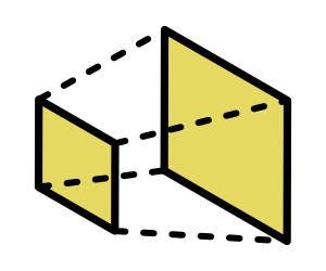
Scanning Range
Survey With Confidence

Across demanding industries such as mining, construction, defense, public safety, and civil infrastructure, Artec Jet delivers highly accurate data for applications such as:
- Digital twins
- As-built documentation
- Site planning
- Volumetric measurements
- Clash detection
- Inspections
- Topographic surveying
- Asset Management

Capture 3D Data In Any Environment
Wherever the job takes you, Artec Jet is ready—indoors or outdoors. It even delivers reliable performance in complete darkness and challenging low-visibility conditions.

Urban Planning

Outdoor

Indoor

Underground
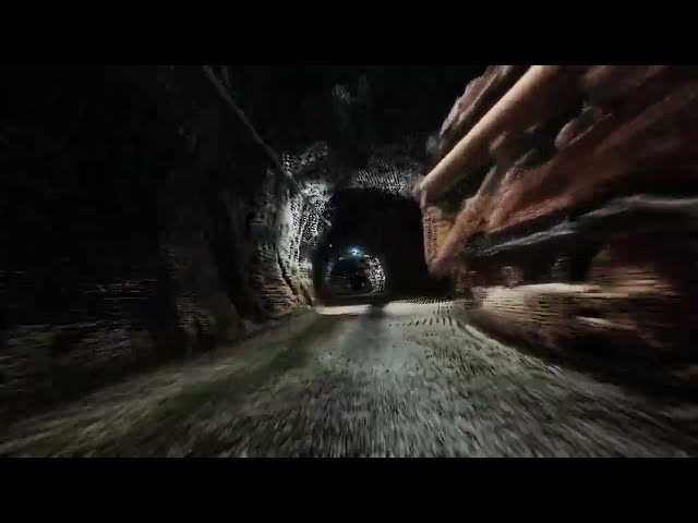
Artec Jet Footage: 3D Mapping of an Underground Tunnel
Process Large-Scale Data in Artec Twins Software

Artec Twins is a processing and visualization platform built for large-scale 3D data that powers the full Artec Jet workflow from raw point cloud capture to analysis-ready output in these steps:
- Process: Convert raw scans into accurate point clouds with the ability to batch-process multiple scans.
- Georeference: Automated tools remove drift and georeference your scans.
- Merge: Combine scans from multiple sessions and deployment modes into a single, seamless point cloud using SLAM-based non-rigid alignment.
- Visualize: 360° colorization, panoramic overlay, elevation/intensity/time filtering, and surface noise reduction.
- Analyze: Change detection, convergence monitoring, direct measurement. Export as LAS, LAZ, PLY, DXF, or E57 for scan-to-BIM workflows.
One Scanner, Seven Deployment Options
Artec Jet’s advanced SLAM algorithms provide dependable performance you can trust across seven modes: handheld, backpack, drone, vehicle, robot, pole, and cage. Select the option that fits your current project. One device, one workflow, one investment—endless possibilities. Replace an entire fleet of tools with one scanner.

Backpack

3D Model of Park using Backpack

Vehicle mount

Urban mapping made with vehicle mount

Drone

Underground tunnel mapping using drone
One Ecosystem: Combine Scans from Multiple Artec 3D Scanners
Get the full capability of the Artec ecosystem. Artec Jet extends Artec 3D’s range from large-scale site capture to detailed component geometry. Within one seamless workflow that delivers precision exactly where it’s needed—efficiently and accurately.

Scan the Environment

Scan For More Details

Combine Data in Artec Twins Software


With more than two and a half decades of expertise in 3D scanning, we serve various industries including automotive, education, scientific research, medical, arts, heritage preservation, aerospace, military, and manufacturing.
We are proud to be Artec’s Gold-Certified Ambassador, serving clients across the United States.

FAQ
Common questions you might have about the Artec Jet.
How long does an Artec Jet scan typically take?
A typical Artec Jet scan can range from a few minutes to several hours, depending on the size and complexity of the area. Because the system captures data continuously as it moves, large environments can often be covered in a single pass, greatly reducing field time compared to static scanning methods.
What is included when I buy the Artec Jet?
Artec Jet comes with everything you need for 3D scanning environments:
- the device
- a battery and charger
- handle
- cable bag and battery cable for walking scans
- belt clip
- international power adapter set
- quick start guide
- Optional accessories include a long-range communication radio and action camera mount for full-color workflows
Does the Artec Jet capture color information?
Artec Jet records precise LiDAR point clouds with intensity data as standard. To generate true-color (RGB) point clouds, an optional action camera can be attached directly to the scanner. During processing, Artec Twins automatically maps the captured imagery onto the point cloud, enriching it with visual context for analysis and visualization.
For many uses—such as volumetric measurement, change detection, and structural inspection—standard Artec Jet data is more than sufficient. Color becomes especially useful when you need to identify materials, assess surface conditions, or detect contamination.
Do I need to get a drone separately?
Yes, drones are sold separately. Artec Jet is a scanning payload designed to mount on compatible drone platforms, giving you the flexibility to select the drone that best suits your requirements. It currently supports the DJI M300, DJI M350, and Freefly Astro Max. Please contact us for a list of current compatible drones for the Artec Jet.
Why should I choose GoMeasure3D as my technology supplier when buying an Artec 3D scanner?
GoMeasure3D is an Artec Gold Certified Ambassador in the USA. We've been in business for 25+ years. Our team has many years of knowledge and experience using their hardware and software.
When you select us as your technology partner, our goal is to get you 3D solutions that enhance your work while making you more productive. We’re here to listen to your challenges or a new undertaking. We will work with you to implement 3D scanning and related technologies to make work easier. We’re here to help you get the right equipment for the job. You can count on us!
We have all the Artec 3D scanners readily available at our office to provide you with a demo—in our office, at your location, or virtually in real-time on your computer.
How do I get a quote on Artec Jet?
Contact us to see if you qualify for any special discounts or promotions. We also offer special pricing for educational institutions. Request a Quote →
Book a Free Personalized Web Demo
Scheduling a demo with us is fast and easy. Pick a day and time that works for you and press confirm—that’s it. You’re all set! We’ll email you the meeting instructions and see you there. 👋
We’ll walk you through everything you want to know about 3D scanning and show you how this technology can transform the way you work for your metrology needs.
Schedule a Demo
